Where each figure comes from, how four separate sources are reconciled into one property, what the terms on a record actually mean — and the questions we are asked most often.
Nothing on a FoundRE record is invented. Each field is drawn from a source that exists independently of us, and every figure carries that source and the date it was captured.
Who holds title, when it transferred and for how much. This is where sold prices come from — registered transfers, not what a property was advertised at.
The municipal value for rates purposes, the category it is rated under, and how that value moved between general valuations.
Zoning, and what the scheme permits on that zoning — coverage, height and use, rather than a guess drawn from what is standing there now.
The building footprint, how much of the erf it covers, how many structures stand on it and roughly how tall they are. Measured, so it is marked estimated.
Anyone can pull these four sources. They disagree constantly — different keys, different boundaries, different vintages — and reconciling them is where the real work sits. That reconciliation is the product: you open one property, already resolved, with the places the sources disagreed still visible rather than quietly smoothed over.
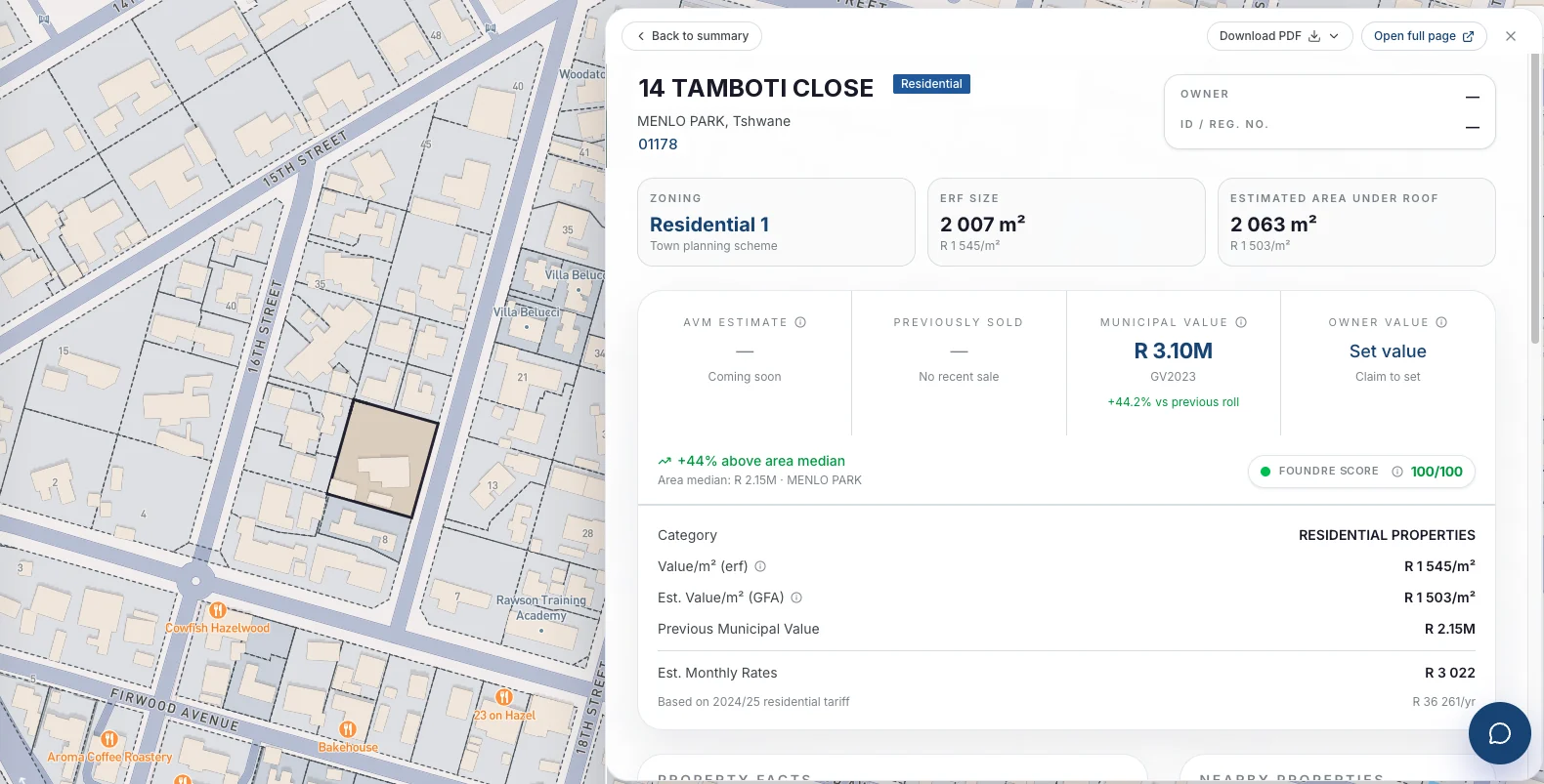
Screens captured from the platform · Property identifiers replaced with an invented record
South African property records carry a vocabulary of their own, much of it inherited from the registry rather than written for a reader. This is what the terms you will meet on FoundRE mean.
If yours is not here, ask us directly — we would rather answer it than have you guess.
No. Every property in the coverage area is already on the map, whether it is for sale or not. Nothing in FoundRE depends on a listing existing, which is the whole point — most of the market is not advertised at any given moment.
From registered transfers at the deeds office. They are what a property actually changed hands for, not what it was asking. Each one carries the date it was registered.
No. FoundRE's estimate is automated — a statistical figure with a stated range, shown next to the municipal value and the comparable transfers it was drawn from. It is a starting point and a sanity check, not a substitute for a professional valuation where one is required.
Because personal information is not shown to someone without the standing to see it. The record is complete; the personal fields are withheld by design, in line with POPIA.
No. Access is on a subscription, and the cost does not move with how many properties you open. Charging per lookup penalises exactly the behaviour the product is for.
It depends on the source — the registry, the valuation roll and the planning scheme each move on their own schedule, and a general valuation resets municipal values for a whole municipality at once. Rather than claim a single refresh rate, every figure shows the date it was captured, so you can see for yourself how fresh it is.
Coverage is expanding municipality by municipality. Get in touch and we will tell you whether the area you work in is live and when it is due.
A data API is part of the platform's roadmap. If you need the record inside your own system rather than on our map, talk to us about what that would need to look like.
A Property Report — headline figures, location, ownership and transfer history, valuation summary, building intelligence and area context — is available now. Suburb, Town and AVM reports are in build or on the roadmap. The features page shows what each one contains.
Ask us about coverage, sources, or anything on this page. We answer as specifically as we can.
 FoundRE